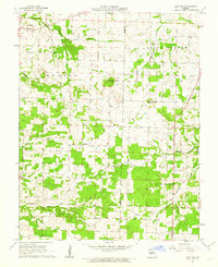
1961 Map of Half Way
USGS Topo · Published 1962About this map
Half Way serves as a central point of reference in this early 1960s study of the Polk and Dallas County borderlands. The landscape is defined by the drainage systems of Coon Creek, Lindley Creek, and Greasy Creek, which dictate the placement of small agricultural settlements and rural infrastructure. The map reveals a dense network of local history markers, including several family and community burial grounds such as Garden Cem, Ankrom Cem, and Viles Cem.
Find a feature on this map
29 named features on this map. Tap any name to fly to it.
Don’t see what you’re looking for? This feature index may not catch every label — zoom into the map to look around manually.
Map Details
Editions of this 1961 Half Way Map
2 editions found
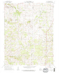
Other maps of this area

1884 · Springfield
USGS Topo · 1:125,000

1884 · Bolivar
USGS Topo · 1:125,000

1886 · Springfield
USGS Topo · 1:125,000

1892 · Bolivar
USGS Topo · 1:125,000

1947 · Strafford
USGS Topo · 1:62,500

1948 · Strafford
USGS Topo · 1:62,500

1950 · Buffalo NW
USGS Topo · 1:24,000

1950 · Polk
USGS Topo · 1:24,000

1951 · Buffalo NW
USGS Topo · 1:24,000

1951 · Polk
USGS Topo · 1:24,000