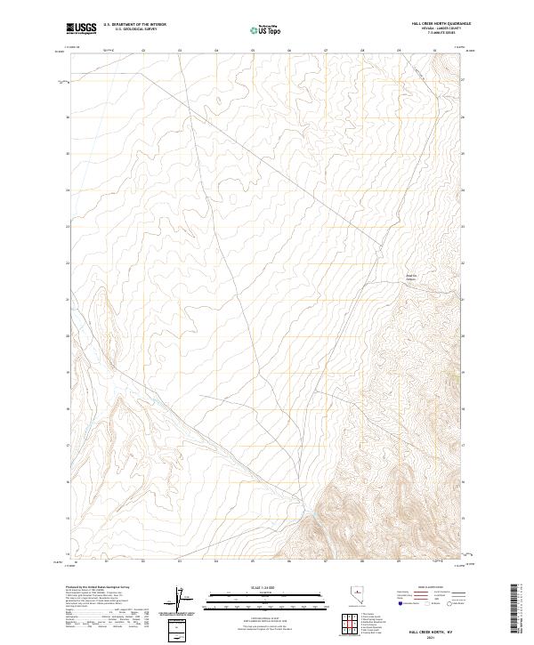
2021 Map of Hall Creek North
USGS Topo · Published 2021About this map
Hall Cr and Iowa Cr carve their way through the high desert drainage systems of this Lander County landscape. The terrain is characterized by the prominent depression of Dead Ox Canyon in the eastern portion of the survey, while Carico Lake Rd provides the primary transit corridor through the northern sections. This 2021 topographic study illustrates the sparse development and strict section lines of the Public Land Survey System, spanning Township 23 North through Township 25 North. The map reflects a modern record of the arid Nevada interior, where water courses and seasonal drainages dictate the location of primitive routes and access points across the basin and range province.
Find a feature on this map
10 named features on this map. Tap any name to fly to it.
Don’t see what you’re looking for? This feature index may not catch every label — zoom into the map to look around manually.
Map Details
Editions of this 2021 Hall Creek North Map
This is the sole edition of this map. No revisions or reprints were ever made.
Other maps of this area

1926 · Roberts Mountains
USGS Topo · 1:250,000

1929 · Roberts Mountains
USGS Topo · 1:250,000

1932 · Sonoma Range
USGS Topo · 1:250,000

1939 · Sonoma Range
USGS Topo · 1:250,000

1955 · Millett
USGS Topo · 1:250,000

1955 · Winnemucca
USGS Topo · 1:250,000

1956 · Hall Creek
USGS Topo · 1:62,500

1958 · Winnemucca
USGS Topo · 1:250,000

1959 · Millett
USGS Topo · 1:250,000

1961 · The Cedars
USGS Topo · 1:62,500