
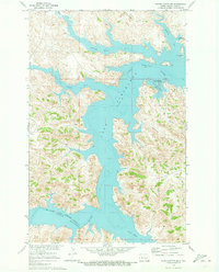
1970 Map of Halliday NW
USGS Topo · Published 1973About this map
The Fort Berthold Indian Reservation Boundary cuts across this prairie landscape in Dunn County, marking the edge of Tribal lands as they meet the rising waters of the Missouri River Basin. Much of the northern terrain is defined by the expansive Lake Sakakawea, where the irregular shoreline creates deep inlets like Wolf Chief Bay. This 1970 field-checked survey illustrates a transitional period for the region, documenting areas subject to controlled inundation as the reservoir system matured. Away from the water, the topography is carved by drainage systems including Hans Creek and North Creek. The map also traces a significant Pipeline traversing the southwestern sections, reflecting the energy infrastructure underlying the rural North Dakota plains.
Find a feature on this map
7 named features on this map. Tap any name to fly to it.
Don’t see what you’re looking for? This feature index may not catch every label — zoom into the map to look around manually.
Map Details
Editions of this 1970 Halliday NW Map
This is the sole edition of this map. No revisions or reprints were ever made.
Other maps of this area

1953 · Watford City
USGS Topo · 1:250,000

1957 · Watford City
USGS Topo · 1:250,000

1967 · Watford City
USGS Topo · 1:250,000

1970 · Halliday NE
USGS Topo · 1:24,000

1970 · Hay Flat
USGS Topo · 1:24,000

1970 · Dunn Center NE
USGS Topo · 1:24,000

1970 · Mandaree SE
USGS Topo · 1:24,000
1970 · Saddle Butte SW
USGS Topo · 1:24,000

1973 · Halliday
USGS Topo · 1:24,000

1973 · Dunn Center
USGS Topo · 1:24,000