
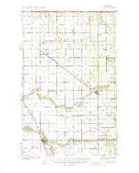
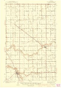
1941 Map of Hallock
USGS Topo · Published 1941About this map
The Hallock vicinity in Kittson County serves as a significant crossroads in the Red River Valley just prior to the Second World War. The town of Hallock acts as the regional hub, situated where the Minneapolis St Paul and Sault Ste Marie railroad cuts diagonally across the landscape, connecting smaller settlements like Orleans, Lancaster, and Northcote. The drainage of this prairie land is defined by the winding paths of the North Branch and South Branch of the Two Rivers, as well as an extensive network of man-made channels such as Ditch No 22 and Judicial Ditch No 31. This 1941 edition documents a dense network of rural infrastructure, including numerous country schoolhouses like Grasshopper Sch, Nylander Sch, and Mayflower Sch, which speak to the area's agricultural settlement patterns and community life before mid-century consolidation.
Find a feature on this map
40 named features on this map. Tap any name to fly to it.
Don’t see what you’re looking for? This feature index may not catch every label — zoom into the map to look around manually.
Map Details
Editions of this 1941 Hallock Map
3 editions found
Other maps of this area

1918 · Hemmington
USGS Topo · 1:62,500

1939 · Drayton
USGS Topo · 1:62,500

1939 · Pembina
USGS Topo · 1:62,500

1939 · Kennedy
USGS Topo · 1:62,500

1941 · Kennedy
USGS Topo · 1:62,500

1941 · Drayton
USGS Topo · 1:62,500

1941 · Pembina
USGS Topo · 1:62,500

1952 · Thief River Falls
USGS Topo · 1:250,000

1956 · Thief River Falls
USGS Topo · 1:250,000

1956 · Karlstad
USGS Topo · 1:62,500