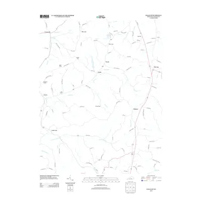
2013 Map of Halls Gap
USGS Topo · Published 2013About this map
Green River headwaters and winding ridges define this portion of Lincoln County, where established rural communities such as Turnersville and Blue Lick have long anchored the landscape. The terrain is deeply carved by water, featuring prominent elevations like Naylor Ridge and Greasy Ridge, alongside distinct valleys such as Boneyard Hollow and Peck Hollow. This 2013 survey illustrates a network of local roads that follow these natural contours, connecting small settlements like Jumbo and Miracle. Significant local history is preserved in the names of thoroughfares like Campbell Cemetery Rd and Waters Cemetery Rd, which point to early family sites. The presence of the Stanford Reservoir and the confluence of the S Fork Green River highlight the area's essential relationship with its water resources, a character shared by the neighboring communities of Highland and South Fork.
Find a feature on this map
95 named features on this map. Tap any name to fly to it.
Don’t see what you’re looking for? This feature index may not catch every label — zoom into the map to look around manually.
Map Details
Editions of this 2013 Halls Gap Map
This is the sole edition of this map. No revisions or reprints were ever made.
Other maps of this area

1905 · Harrodsburg
USGS Topo · 1:125,000

1952 · Halls Gap
USGS Topo · 1:24,000

1952 · Eubank
USGS Topo · 1:24,000

1952 · Crab Orchard
USGS Topo · 1:24,000

1952 · Hustonville
USGS Topo · 1:24,000

1952 · Lancaster
USGS Topo · 1:24,000

1952 · Yosemite
USGS Topo · 1:24,000

1952 · Stanford
USGS Topo · 1:24,000

1952 · Junction City
USGS Topo · 1:24,000

1952 · Woodstock
USGS Topo · 1:24,000