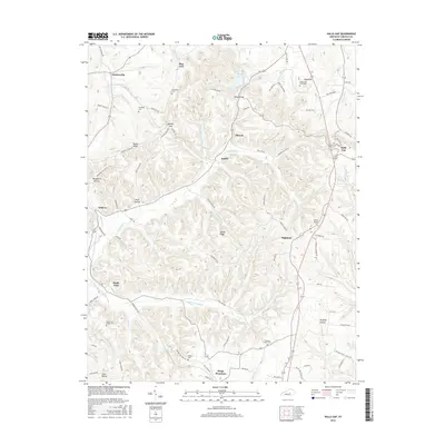
2016 Map of Halls Gap
USGS Topo · Published 2016About this map
Kings Mountain and Halls Gap anchor this portion of Lincoln County, where the topography transitions between high ridges and winding creek bottoms. The landscape is deeply carved by the Green River and its tributaries, including McKinney Cr and Hanging Fork. This environment dictated a settlement pattern of small communities like Turnersville and Geneva positioned along the more accessible valley floors and ridge tops. Family and community heritage is deeply embedded in the land, evidenced by numerous burial sites such as the Sugar Loaf Graveyard, South Fork Church Cem, and Campbell Cem. Notable terrain features like Greasy Ridge and Naylor Ridge dominate the central portion of the map, illustrating the geographical barriers that influenced the local road network, including the path of Greasy Ridge Rd and Moccasin Rd.
Find a feature on this map
89 named features on this map. Tap any name to fly to it.
Don’t see what you’re looking for? This feature index may not catch every label — zoom into the map to look around manually.
Map Details
Editions of this 2016 Halls Gap Map
This is the sole edition of this map. No revisions or reprints were ever made.
Other maps of this area

1905 · Harrodsburg
USGS Topo · 1:125,000

1952 · Halls Gap
USGS Topo · 1:24,000

1952 · Eubank
USGS Topo · 1:24,000

1952 · Crab Orchard
USGS Topo · 1:24,000

1952 · Hustonville
USGS Topo · 1:24,000

1952 · Lancaster
USGS Topo · 1:24,000

1952 · Yosemite
USGS Topo · 1:24,000

1952 · Stanford
USGS Topo · 1:24,000

1952 · Junction City
USGS Topo · 1:24,000

1952 · Woodstock
USGS Topo · 1:24,000