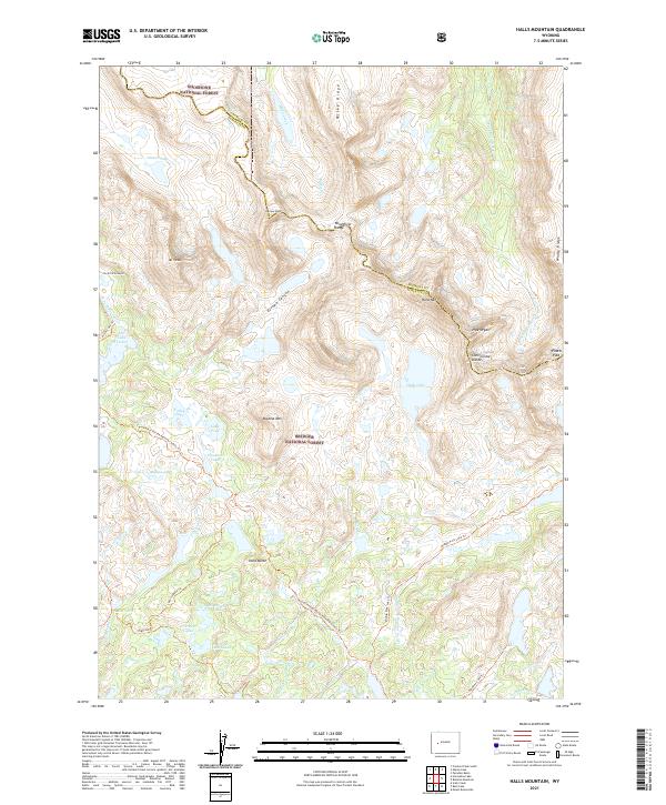
2021 Map of Halls Mountain
USGS Topo · Published 2021About this map
Halls Mtn and the crest of the Wind River Range dominate this 2021 landscape, where the Continental Divide winds through the high country of the Shoshone National Forest and Bridger National Forest. The map documents a complex high-altitude drainage system, including Glacier Lake and the Pipestone Lakes, feeding into the Milky Creek and Middle Fork Boulder Cr watersheds. Local landmarks like Pipe Organ and Photo Pass mark the transition over the divide, while peak-baggers and historians can trace several named trails such as the Continental Divide National Scenic Trl and the Highline Trl. This survey preserves the exact nomenclature of the Fremont Co and Sublette Co line as it stood in the early 21st century, illustrating the intersection of glacial topography and modern recreational access.
Find a feature on this map
48 named features on this map. Tap any name to fly to it.
Don’t see what you’re looking for? This feature index may not catch every label — zoom into the map to look around manually.
Map Details
Editions of this 2021 Halls Mountain Map
This is the sole edition of this map. No revisions or reprints were ever made.
Other maps of this area

1909 · Fremont Peak
USGS Topo · 1:125,000

1938 · Mt Bonneville
USGS Topo · 1:62,500

1941 · Mt Bonneville
USGS Topo · 1:62,500

1942 · Mt Bonneville
USGS Topo · 1:62,500

1952 · Paradise Basin
USGS Topo · 1:24,000

1952 · Alpine Lake
USGS Topo · 1:24,000

1955 · Thermopolis
USGS Topo · 1:250,000

1955 · Lander
USGS Topo · 1:250,000

1958 · Lander
USGS Topo · 1:250,000

1958 · Thermopolis
USGS Topo · 1:250,000