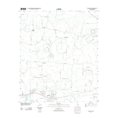
2013 Map of Hallsville
USGS Topo · Published 2013About this map
Hallsville serves as the primary hub in this corner of Harrison County, where the southern portion of the map is defined by the intersection of state and local transit routes. The landscape reflects a transition from the structured street grid of the town to the rolling rural reaches of east Texas, where smaller communities like Noonday and Mulberry Springs are scattered among a network of creeks and bayous. Significant water features such as Little Cypress Bayou and Big Rock Lake define the northern and central drainage patterns, while the presence of several cemeteries, including Friendship Cem and Springhill Cem, offers valuable points of reference for those tracing local family lineages. The area around Walkers Mill and Carterville demonstrates the historical dispersal of rural settlements across the wooded terrain, connected by named country roads that follow the natural contours of the land.
Find a feature on this map
115 named features on this map. Tap any name to fly to it.
Don’t see what you’re looking for? This feature index may not catch every label — zoom into the map to look around manually.
Map Details
Editions of this 2013 Hallsville Map
This is the sole edition of this map. No revisions or reprints were ever made.
Other maps of this area

1956 · Tyler
USGS Topo · 1:250,000

1958 · Darco
USGS Topo · 1:62,500

1958 · Tatum
USGS Topo · 1:62,500

1961 · Hallsville
USGS Topo · 1:24,000

1961 · Harleton
USGS Topo · 1:24,000

1962 · Marshall NW
USGS Topo · 1:24,000

1962 · Marshall West
USGS Topo · 1:24,000

1962 · Ashland
USGS Topo · 1:24,000

1962 · Longview Heights
USGS Topo · 1:24,000

1983 · Easton
USGS Topo · 1:24,000