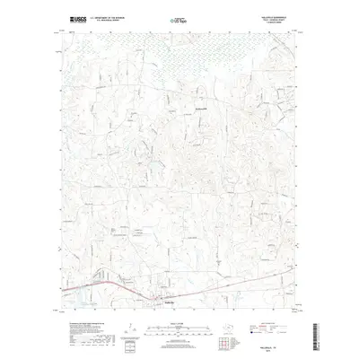
2019 Map of Hallsville
USGS Topo · Published 2019About this map
Hallsville serves as the primary population center on this Harrison County map, showing a landscape defined by the drainage systems of Little Cypress Bayou and Gum Cr. The terrain is characterized by dissected uplands and significant landmarks like Hickory Hill, which overlooks a network of rural roads such as FM 450 and FM 449. The map preserves the locations of several community focal points, including Walkers Mill and the historic site of Hynson Springs. Local genealogy is well-supported by the clear marking of family-named burial grounds like Friendship Cem, Mount Pleasant Cem, Springhill Cem, and Morris Cem. The southern edge of the survey captures the infrastructure corridor along the railroad and W Main St, while the northern reaches remain dominated by the wetlands and meandering paths of Little Cypress Bayou.
Find a feature on this map
113 named features on this map. Tap any name to fly to it.
Don’t see what you’re looking for? This feature index may not catch every label — zoom into the map to look around manually.
Map Details
Editions of this 2019 Hallsville Map
This is the sole edition of this map. No revisions or reprints were ever made.
Other maps of this area

1956 · Tyler
USGS Topo · 1:250,000

1958 · Darco
USGS Topo · 1:62,500

1958 · Tatum
USGS Topo · 1:62,500

1961 · Hallsville
USGS Topo · 1:24,000

1961 · Harleton
USGS Topo · 1:24,000

1962 · Marshall NW
USGS Topo · 1:24,000

1962 · Marshall West
USGS Topo · 1:24,000

1962 · Ashland
USGS Topo · 1:24,000

1962 · Longview Heights
USGS Topo · 1:24,000

1983 · Easton
USGS Topo · 1:24,000