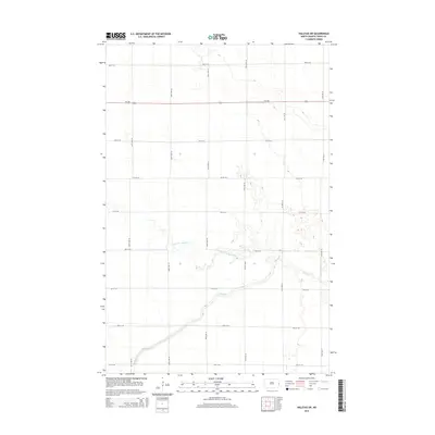
2014 Map of Halstad SW
USGS Topo · Published 2014About this map
The Elm River and its northern tributary, the North Br Elm River, carve a meandering path through the agricultural landscape of Traill County in this 2014 survey. The terrain is defined by a rigorous township-and-range grid of gravel roads, including north-south routes like 167th Ave SE and 172nd Ave SE, and east-west corridors such as 3rd St SE and 11th St SE. Bisecting the upper third of the quadrangle is ND-200, providing a primary paved transit route across the Red River Valley plains. While modern in its production, the map meticulously documents the drainage patterns and precise section lines that have structured farming in this region since the original land grants. The lack of concentrated settlements highlights the area's specialized role in large-scale agriculture, where the intersection of water resources and transportation infrastructure remains central to the local economy.
Find a feature on this map
17 named features on this map. Tap any name to fly to it.
Don’t see what you’re looking for? This feature index may not catch every label — zoom into the map to look around manually.
Map Details
Editions of this 2014 Halstad SW Map
This is the sole edition of this map. No revisions or reprints were ever made.
Other maps of this area

1918 · Kelso
USGS Topo · 1:62,500

1918 · Hendrum
USGS Topo · 1:62,500

1943 · Kelso
USGS Topo · 1:62,500

1952 · Grand Forks
USGS Topo · 1:250,000

1956 · Grand Forks
USGS Topo · 1:250,000

1963 · Shelly
USGS Topo · 1:24,000

1963 · Perley
USGS Topo · 1:24,000

1963 · Gardner
USGS Topo · 1:24,000

1963 · Halstad
USGS Topo · 1:24,000

1963 · Hillsboro
USGS Topo · 1:24,000