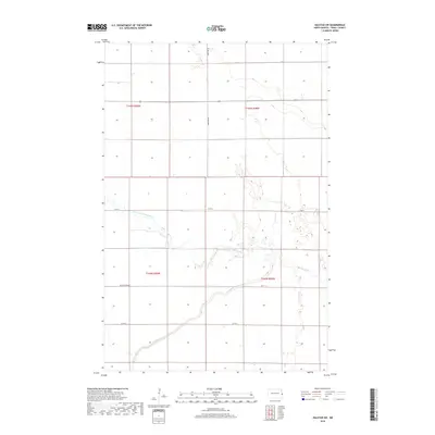
2018 Map of Halstad SW
USGS Topo · Published 2018About this map
The winding course of the Elm River defines this rural stretch of Traill County, as seen in this 2018 survey. The landscape is characterized by the intricate drainage patterns of the North Branch Elm River and the N Br Elm River, which meander through a highly structured grid of section lines and township boundaries. The map illustrates a strictly organized agricultural environment where human management of the Red River Valley's hydrology is evident. Engineering for water control is prominent in the form of the Kelso Floodway, which runs east-west across the southern half of the quadrangle. Local transportation is maintained by a network of rural routes, including Co Hwy 1 and Co Rd 3, which serve the large farmsteads and fields that dominate this Red River Valley terrain.
Find a feature on this map
12 named features on this map. Tap any name to fly to it.
Don’t see what you’re looking for? This feature index may not catch every label — zoom into the map to look around manually.
Map Details
Editions of this 2018 Halstad SW Map
This is the sole edition of this map. No revisions or reprints were ever made.
Other maps of this area

1918 · Kelso
USGS Topo · 1:62,500

1918 · Hendrum
USGS Topo · 1:62,500

1943 · Kelso
USGS Topo · 1:62,500

1952 · Grand Forks
USGS Topo · 1:250,000

1956 · Grand Forks
USGS Topo · 1:250,000

1963 · Shelly
USGS Topo · 1:24,000

1963 · Perley
USGS Topo · 1:24,000

1963 · Gardner
USGS Topo · 1:24,000

1963 · Halstad
USGS Topo · 1:24,000

1963 · Hillsboro
USGS Topo · 1:24,000