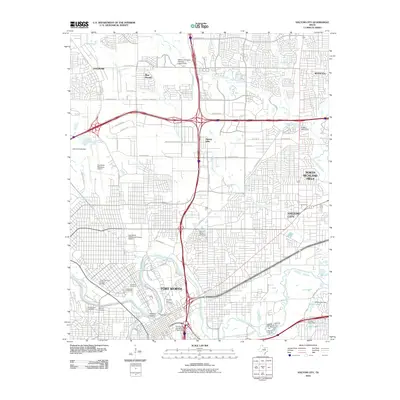
2010 Map of Haltom City
USGS Topo · Published 2010About this map
Fort Worth and its surrounding suburbs appear as a dense urban and industrial landscape at the start of the 2010s, shaped by the waters of the West Fork Trinity River. The map highlights a significant concentration of historical and civic sites north of the city center, including the Fort Worth Stockyards Historic District and the Grand Avenue Historic District. This area is a cornerstone for genealogists, as it contains a massive cluster of burial grounds such as Mount Olivet Cemetery, Oakwood Cemetery, and the historic Pioneers Rest Cemetery.
Find a feature on this map
70 named features on this map. Tap any name to fly to it.
Don’t see what you’re looking for? This feature index may not catch every label — zoom into the map to look around manually.
Map Details
Editions of this 2010 Haltom City Map
This is the sole edition of this map. No revisions or reprints were ever made.
Other maps of this area

1894 · Fort Worth
USGS Topo · 1:125,000

1931 · Grapevine
USGS Topo · 1:62,500

1954 · Dallas
USGS Topo · 1:250,000

1955 · Haltom City
USGS Topo · 1:24,000

1955 · Avondale
USGS Topo · 1:24,000

1955 · Keller
USGS Topo · 1:24,000

1955 · Lake Worth
USGS Topo · 1:24,000

1955 · Benbrook
USGS Topo · 1:24,000

1955 · Fort Worth
USGS Topo · 1:24,000

1955 · Haltom City
USGS Topo · 1:62,500