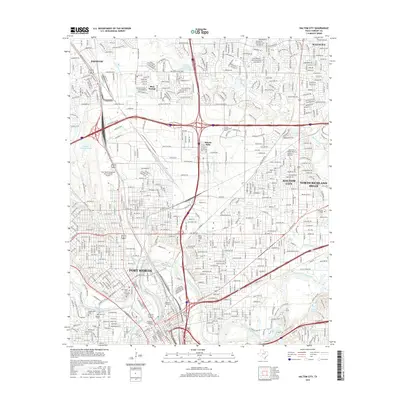
2016 Map of Haltom City
USGS Topo · Published 2016About this map
Fort Worth and its northeastern suburbs are anchored by the confluence of the West Fork Trinity River and the Clear Fork Trinity River. This 2016 survey highlights the intricate network of cemeteries clustered north of the downtown core, including the sprawling Mount Olivet Cemetery and the historic Pioneers Rest Cemetery, which provide significant genealogical data for the region. The landscape is defined by the heavy infrastructure of the Fort Worth Meacham International Airport and the sprawling rail and highway corridors that connect Haltom City, Saginaw, and Blue Mound. North of the river, the terrain is marked by industrial landmarks like the Western Company Training Lagoon and local water bodies such as Fosdic Lake and White Lake, reflecting the intensive urban and industrial development of Tarrant County in the early 21st century.
Find a feature on this map
37 named features on this map. Tap any name to fly to it.
Don’t see what you’re looking for? This feature index may not catch every label — zoom into the map to look around manually.
Map Details
Editions of this 2016 Haltom City Map
This is the sole edition of this map. No revisions or reprints were ever made.
Other maps of this area

1894 · Fort Worth
USGS Topo · 1:125,000

1931 · Grapevine
USGS Topo · 1:62,500

1954 · Dallas
USGS Topo · 1:250,000

1955 · Haltom City
USGS Topo · 1:24,000

1955 · Avondale
USGS Topo · 1:24,000

1955 · Keller
USGS Topo · 1:24,000

1955 · Lake Worth
USGS Topo · 1:24,000

1955 · Benbrook
USGS Topo · 1:24,000

1955 · Fort Worth
USGS Topo · 1:24,000

1955 · Haltom City
USGS Topo · 1:62,500