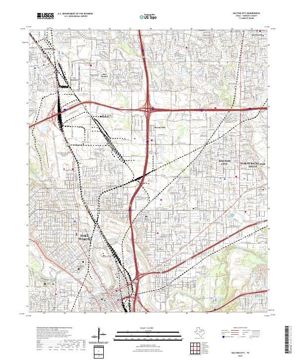
2022 Map of Haltom City
USGS Topo · Published 2022About this map
Fort Worth and its northeastern suburbs form a dense network of residential streets and industrial corridors where the West Fork Trinity River and Clear Fork Trinity River converge. The landscape is heavily shaped by modern infrastructure, including the massive Fort Worth Meacham International Airport and a series of major thoroughfares like the Jim Wright Fwy NE and North Fwy. Amidst the urban expansion of Haltom City and North Richland Hills, numerous historic resting places remain, such as the expansive Mount Olivet Cemetery and the venerable Pioneers Rest Cem. Near the city center, civic life is anchored by the Tarrant County Courthouse and the Tarrant County College Trinity River Campus East, reflecting the continued evolution of the downtown riverfront area.
Find a feature on this map
30 named features on this map. Tap any name to fly to it.
Don’t see what you’re looking for? This feature index may not catch every label — zoom into the map to look around manually.
Map Details
Editions of this 2022 Haltom City Map
This is the sole edition of this map. No revisions or reprints were ever made.
Other maps of this area

1894 · Fort Worth
USGS Topo · 1:125,000

1931 · Grapevine
USGS Topo · 1:62,500

1954 · Dallas
USGS Topo · 1:250,000

1955 · Haltom City
USGS Topo · 1:24,000

1955 · Avondale
USGS Topo · 1:24,000

1955 · Keller
USGS Topo · 1:24,000

1955 · Lake Worth
USGS Topo · 1:24,000

1955 · Benbrook
USGS Topo · 1:24,000

1955 · Fort Worth
USGS Topo · 1:24,000

1955 · Haltom City
USGS Topo · 1:62,500