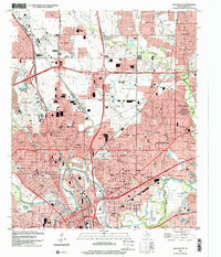
1995 Map of Haltom City
USGS Topo · Published 2001About this map
Fort Worth and its northeastern suburbs are documented here during a period of significant late-century urbanization. The landscape is defined by the confluence of the West Fork Trinity River and the Clear Fork Trinity River, where the city's historic core and early industrial zones were established. Major transportation hubs like the Fort Worth Meacham International Airport and numerous rail lines, including the St Louis Southwestern RR and Burlington Northern RR, illustrate the area's role as a regional transit and logistics center.
Find a feature on this map
110 named features on this map. Tap any name to fly to it.
Don’t see what you’re looking for? This feature index may not catch every label — zoom into the map to look around manually.
Map Details
Editions of this 1995 Haltom City Map
This is the sole edition of this map. No revisions or reprints were ever made.
Other maps of this area

1894 · Fort Worth
USGS Topo · 1:125,000

1931 · Grapevine
USGS Topo · 1:62,500

1954 · Dallas
USGS Topo · 1:250,000

1955 · Haltom City
USGS Topo · 1:24,000

1955 · Avondale
USGS Topo · 1:24,000

1955 · Keller
USGS Topo · 1:24,000

1955 · Lake Worth
USGS Topo · 1:24,000

1955 · Benbrook
USGS Topo · 1:24,000

1955 · Fort Worth
USGS Topo · 1:24,000

1955 · Haltom City
USGS Topo · 1:62,500