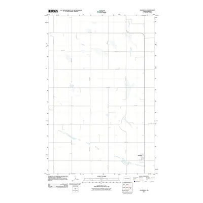
2011 Map of Hamberg
USGS Topo · Published 2011About this map
Hamberg serves as the primary focal point of this Wells County survey, situated at the intersection of a sprawling rural road network and the natural drainage of Big Slough. The landscape is defined by the rigid North Dakota section-line grid, where routes like 31st St Ne and 50th Ave Ne stretch across a prairie terrain marked by scattered wetlands and glacial depressions. Within the small settlement, Main St provides the central axis for local transit. The presence of Big Slough illustrates the subtle hydrology of the region, winding through the southern and central portions of the quadrangle as a series of intermittent water bodies and low-lying marshes that dictate the placement of farms and field boundaries.
Find a feature on this map
17 named features on this map. Tap any name to fly to it.
Don’t see what you’re looking for? This feature index may not catch every label — zoom into the map to look around manually.
Map Details
Editions of this 2011 Hamberg Map
This is the sole edition of this map. No revisions or reprints were ever made.
Other maps of this area

1932 · Flora
USGS Topo · 1:62,500

1943 · Maddock
USGS Topo · 1:62,500

1945 · Maddock
USGS Topo · 1:62,500

1948 · Cathay
USGS Topo · 1:62,500

1948 · Fessenden
USGS Topo · 1:62,500

1948 · Bremen
USGS Topo · 1:24,000

1949 · Bremen
USGS Topo · 1:24,000

1949 · Fessenden East
USGS Topo · 1:24,000

1949 · Fessenden West
USGS Topo · 1:24,000

1951 · Black Hammer Hill
USGS Topo · 1:24,000