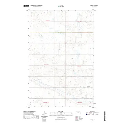
2020 Map of Hamberg
USGS Topo · Published 2020About this map
Hamberg serves as the quiet focal point of this rural prairie landscape in Wells County, situated near the boundary line of Benson Co. The township is defined by a rigorous grid of section lines and gravel roads, including Co Rd 5 and 50th Ave NE, which connect isolated farmsteads across the undulating terrain. A significant natural feature of the area is Big Slough, which meanders across the southern portion of the quadrangle, creating a marshy corridor amidst the vast agricultural fields. For those tracing family ties to this corner of North Dakota, the Hamberg Lutheran Cem remains a primary landmark on the outskirts of the townsite, marking the enduring presence of the local community. The map's detailed hydrography reveals a landscape dotted with numerous small depressions and seasonal wetlands characteristic of the northern plains.
Find a feature on this map
25 named features on this map. Tap any name to fly to it.
Don’t see what you’re looking for? This feature index may not catch every label — zoom into the map to look around manually.
Map Details
Editions of this 2020 Hamberg Map
This is the sole edition of this map. No revisions or reprints were ever made.
Other maps of this area

1932 · Flora
USGS Topo · 1:62,500

1943 · Maddock
USGS Topo · 1:62,500

1945 · Maddock
USGS Topo · 1:62,500

1948 · Cathay
USGS Topo · 1:62,500

1948 · Fessenden
USGS Topo · 1:62,500

1948 · Bremen
USGS Topo · 1:24,000

1949 · Bremen
USGS Topo · 1:24,000

1949 · Fessenden East
USGS Topo · 1:24,000

1949 · Fessenden West
USGS Topo · 1:24,000

1951 · Black Hammer Hill
USGS Topo · 1:24,000