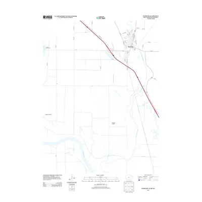
2013 Map of Hamburg
USGS Topo · Published 2013About this map
Hamburg sits at the nexus of the Missouri River and Nishnabotna River bottomlands, occupying a critical corner where Iowa, Missouri, and Nebraska converge. The town's grid is defined by a series of lettered streets from C St to R St, situated just east of the Iowa Drainage Ditch. The surrounding landscape is dominated by the complex hydrology of the floodplains, featuring notable landforms like McKissick Island and the historical boundary of the Platte Purchase. Significant water management features, including Main Ditch Number Six and High Creek, illustrate the long-standing effort to drain and utilize these fertile river valley soils. To the south, the meandering Nishnabotna River cuts a wide path near Greys Lake, while the Hamburg-Mitchell Access provides a recreational connection to the Missouri River corridor.
Find a feature on this map
53 named features on this map. Tap any name to fly to it.
Don’t see what you’re looking for? This feature index may not catch every label — zoom into the map to look around manually.
Map Details
Editions of this 2013 Hamburg Map
This is the sole edition of this map. No revisions or reprints were ever made.
Other maps of this area

1907 · Nebraska City
USGS Topo · 1:62,500

1915 · Nemaha
USGS Topo · 1:62,500

1915 · Howe
USGS Topo · 1:62,500

1939 · Hamburg
USGS Topo · 1:62,500

1939 · Nemaha
USGS Topo · 1:62,500

1941 · Hamburg
USGS Topo · 1:62,500

1949 · Nemaha
USGS Topo · 1:62,500

1955 · Nebraska City
USGS Topo · 1:250,000

1957 · Nebraska City
USGS Topo · 1:250,000

1958 · Nebraska City
USGS Topo · 1:250,000