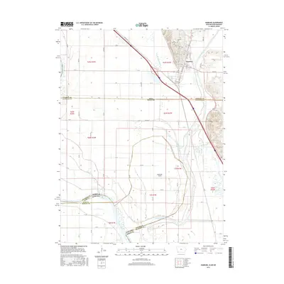
2015 Map of Hamburg
USGS Topo · Published 2015About this map
The Missouri River corridor serves as the complex meeting point of Iowa, Missouri, and Nebraska, defining a landscape shaped by both hydrology and political boundaries. The town of Hamburg sits at the foot of the bluffs in Fremont County, where the Nishnabotna River and numerous man-made channels like the Iowa Drainage Ditch and Main Ditch Number Six manage the fertile but flood-prone bottomlands. This area is notable for its intricate state-line shifts, particularly around McKissick Island, a piece of Nebraska land left on the eastern side of the river due to historic channel changes. Local heritage is centered around the community at the base of the hills, where Hamburg Cem and Saint Marys Cem overlook the valley. The map details the transition from the river's active floodplain and Grey's Lake to the organized section lines and rural road networks that support the region's agricultural economy.
Find a feature on this map
77 named features on this map. Tap any name to fly to it.
Don’t see what you’re looking for? This feature index may not catch every label — zoom into the map to look around manually.
Map Details
Editions of this 2015 Hamburg Map
This is the sole edition of this map. No revisions or reprints were ever made.
Other maps of this area

1907 · Nebraska City
USGS Topo · 1:62,500

1915 · Nemaha
USGS Topo · 1:62,500

1915 · Howe
USGS Topo · 1:62,500

1939 · Hamburg
USGS Topo · 1:62,500

1939 · Nemaha
USGS Topo · 1:62,500

1941 · Hamburg
USGS Topo · 1:62,500

1949 · Nemaha
USGS Topo · 1:62,500

1955 · Nebraska City
USGS Topo · 1:250,000

1957 · Nebraska City
USGS Topo · 1:250,000

1958 · Nebraska City
USGS Topo · 1:250,000