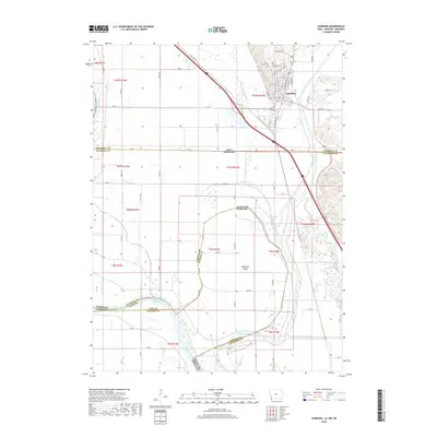
2018 Map of Hamburg
USGS Topo · Published 2018About this map
Hamburg sits at a geographic crossroads where the borders of Iowa, Missouri, and Nebraska converge near the shifting currents of the Missouri River. This landscape is defined by the complex hydrology of the Missouri floodplain, managed through an extensive network of engineered waterways including the Iowa Drainage Ditch and Main Ditch Number Six. A peculiar jurisdictional legacy is visible at McKissick Island, a tract of land that remains part of Nebraska despite now lying east of the river's main channel. The town's local history is anchored by Saint Mary's Cem and Hamburg Cem, while the residential grid reaches toward the bluffs along Skyline Dr and Apple Mount Dr. The Nishnabotna River meanders through the eastern portion of the map, illustrating the fertile but flood-prone bottomlands that have dictated the region's development and agricultural patterns.
Find a feature on this map
81 named features on this map. Tap any name to fly to it.
Don’t see what you’re looking for? This feature index may not catch every label — zoom into the map to look around manually.
Map Details
Editions of this 2018 Hamburg Map
This is the sole edition of this map. No revisions or reprints were ever made.
Other maps of this area

1907 · Nebraska City
USGS Topo · 1:62,500

1915 · Nemaha
USGS Topo · 1:62,500

1915 · Howe
USGS Topo · 1:62,500

1939 · Hamburg
USGS Topo · 1:62,500

1939 · Nemaha
USGS Topo · 1:62,500

1941 · Hamburg
USGS Topo · 1:62,500

1949 · Nemaha
USGS Topo · 1:62,500

1955 · Nebraska City
USGS Topo · 1:250,000

1957 · Nebraska City
USGS Topo · 1:250,000

1958 · Nebraska City
USGS Topo · 1:250,000