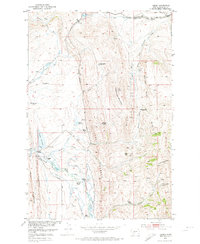
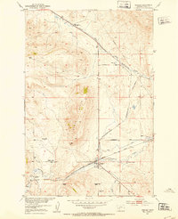
1951 Map of Hamen
USGS Topo · Published 1974About this map
The Chicago Milwaukee St Paul and Pacific railroad cuts through the heart of this Montana landscape, tracing a path past the small settlement of Hamen and the high-elevation siding at Loweth. This mid-century survey captures the ranching character of Meagher County, where family operations like the Higgins Ranch, Lucas Ranch, and Kiff Ranch are distributed across the high plains and foothills. The presence of the Tip Top School and multiple sites marked as abandoned, such as the Higgins Homestead and Petzold Ranch, points to a shifting rural population as smaller claims consolidated. The terrain is defined by the continental divide's water systems, including the South Fork Smith River and the Musselshell River, with prominent landmarks like Reservation Mountain and Punk Mountain framing the various creek drainages and reservoirs.
Find a feature on this map
34 named features on this map. Tap any name to fly to it.
Don’t see what you’re looking for? This feature index may not catch every label — zoom into the map to look around manually.
Map Details
Editions of this 1951 Hamen Map
4 editions found
Other maps of this area

1886 · Little Belt Mts.
USGS Topo · 1:250,000

1894 · Little Belt Mts.
USGS Topo · 1:250,000

1897 · Little Belt Mts.
USGS Topo · 1:250,000

1898 · Little Belt Mts.
USGS Topo · 1:250,000

1902 · Little Belt Mts.
USGS Topo · 1:250,000

1948 · White Sulphur Springs
USGS Topo · 1:250,000

1951 · Sixteen NE
USGS Topo · 1:24,000

1951 · Hamen
USGS Topo · 1:24,000
1951 · Wolf Hill
USGS Topo · 1:24,000
1951 · Ringling
USGS Topo · 1:24,000