
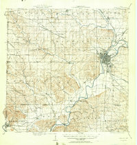
1915 Map of Hamilton
USGS Topo · Published 1915About this map
The Miami River corridor dominates this 1915 survey, revealing the industrial and transportation infrastructure of Butler County. The city of Hamilton appears as a dense hub of activity, where the Miami and Erie Canal meets a complex network of railroads including the Cincinnati Hamilton and Dayton. The map documents a transition in transit, showing both traditional steam lines and the Cincinnati and Dayton Electric interurban line.
Find a feature on this map
91 named features on this map. Tap any name to fly to it.
Don’t see what you’re looking for? This feature index may not catch every label — zoom into the map to look around manually.
Map Details
Editions of this 1915 Hamilton Map
2 editions found
Other maps of this area

1898 · East Cincinnati
USGS Topo · 1:62,500

1904 · Mason
USGS Topo · 1:62,500

1906 · Mason
USGS Topo · 1:62,500

1908 · Miamisburg
USGS Topo · 1:62,500

1911 · Oxford
USGS Topo · 1:62,500

1914 · East Cincinnati
USGS Topo · 1:62,500

1914 · West Cincinnati
USGS Topo · 1:62,500

1915 · Lawrenceburg
USGS Topo · 1:48,000

1915 · College Corner
USGS Topo · 1:48,000

1915 · Harrison
USGS Topo · 1:48,000