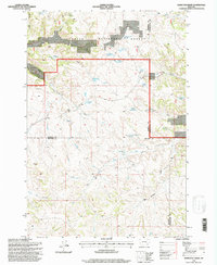
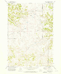
1995 Map of Hamilton Draw
USGS Topo · Published 1998About this map
Custer National Forest lands dominate the northern reaches of this Montana landscape, where the high-plains topography is defined by an intricate network of seasonal drainages and essential water improvements. The map illustrates a ranching and livestock economy through its numerous named water catchments, including Hamilton Draw Reservoir, Lee Creek Reservoir, and Boyce Reservoir. These man-made features, alongside natural points like Tooley Spring and Loggins Spring, reveal the critical importance of water management in this arid region. The terrain is further characterized by deep incisions such as Hamilton Draw and Davidson Draw. Straddling the borders of Rosebud, Powder River, and Big Horn counties, the area shows little in the way of permanent settlement, instead emphasizing the topographical survey of the land's natural contours and the scattered Gravel Pits that suggest local infrastructure maintenance during the late twentieth century.
Find a feature on this map
31 named features on this map. Tap any name to fly to it.
Don’t see what you’re looking for? This feature index may not catch every label — zoom into the map to look around manually.
Map Details
Editions of this 1995 Hamilton Draw Map
This is the sole edition of this map. No revisions or reprints were ever made.
Other maps of this area

1954 · Hardin
USGS Topo · 1:250,000

1957 · Hardin
USGS Topo · 1:250,000

1958 · Hardin
USGS Topo · 1:250,000

1966 · Browns Mountain
USGS Topo · 1:24,000

1966 · Poker Jim Butte
USGS Topo · 1:24,000

1966 · Fort Howes
USGS Topo · 1:24,000
1972 · Stroud Creek
USGS Topo · 1:24,000
1972 · Forks Ranch
USGS Topo · 1:24,000
1972 · Bear Creek School
USGS Topo · 1:24,000
1972 · Hamilton Draw
USGS Topo · 1:24,000