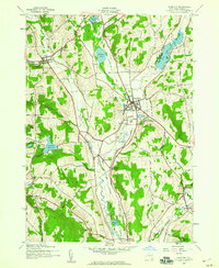
1943 Map of Hamilton
USGS Topo · Published 1960About this map
Colgate University sits at the heart of this mid-century survey, overlooking Hamilton and the surrounding glacial landscape of Madison County. The village is a hub of transport and education, with the New York Ontario and Western RR cutting through the valley and the Delaware Lackawanna and Western RR serving the southern reaches near Poolville and Earlville. Significant water bodies like Lake Moraine and Woodman Pond define the northern terrain, while the Chenango River follows the lowlands alongside abandoned sections of the old canal route.
Find a feature on this map
41 named features on this map. Tap any name to fly to it.
Don’t see what you’re looking for? This feature index may not catch every label — zoom into the map to look around manually.
Map Details
Editions of this 1943 Hamilton Map
3 editions found
Other maps of this area

1902 · Morrisville
USGS Topo · 1:62,500

1903 · Norwich
USGS Topo · 1:62,500

1907 · Sangerfield
USGS Topo · 1:62,500

1910 · New Berlin
USGS Topo · 1:62,500

1912 · New Berlin
USGS Topo · 1:62,500

1943 · Otselic
USGS Topo · 1:24,000

1943 · West Eaton
USGS Topo · 1:24,000

1943 · Morrisville
USGS Topo · 1:24,000

1943 · Hubbardsville
USGS Topo · 1:24,000

1943 · Sangerfield
USGS Topo · 1:62,500