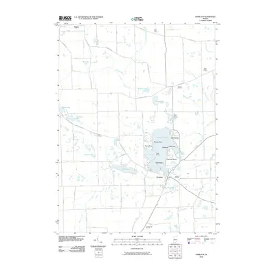
2010 Map of Hamilton
USGS Topo · Published 2010About this map
Hamilton Lake serves as the central focal point of this region, surrounded by a cluster of distinct residential and recreational developments. These include Russels Point, Forest Park, Circle Park, and Oakwood Shores, each hugging the shoreline of the lake. The terrain is defined by its glacial history, featuring numerous smaller bodies of water such as Ball Lake, Johnson Lake, and Gooseneck Lake. The extensive drainage network, comprised of several named ditches like the Hiram Sweet Ditch and Lillian Metz Ditch, indicates a landscape heavily modified for agricultural use.
Find a feature on this map
87 named features on this map. Tap any name to fly to it.
Don’t see what you’re looking for? This feature index may not catch every label — zoom into the map to look around manually.
Map Details
Editions of this 2010 Hamilton Map
This is the sole edition of this map. No revisions or reprints were ever made.
Other maps of this area

1939 · Hamilton
USGS Topo · 1:24,000

1939 · Angola East
USGS Topo · 1:24,000

1939 · Clear Lake
USGS Topo · 1:24,000

1940 · Metz
USGS Topo · 1:24,000

1940 · Clear Lake
USGS Topo · 1:24,000

1941 · Angola West
USGS Topo · 1:24,000

1942 · Ashley
USGS Topo · 1:24,000

1942 · Angola West
USGS Topo · 1:24,000

1947 · Angola East
USGS Topo · 1:24,000

1948 · Hamilton
USGS Topo · 1:24,000