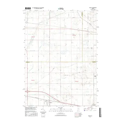
2016 Map of Hamlet
USGS Topo · Published 2016About this map
Hamlet serves as the focal point of this Northwest Indiana survey, situated at the intersection of several prominent regional rail and road corridors. The landscape is defined by an intricate network of artificial waterways, including the Amy Kelly Ditch, Benninghoff Ditch, and Kyle Ditch, which drain the low-lying agricultural lands characteristic of the Kankakee River basin. This highly engineered drainage system illustrates the historic conversion of the Grand Kankakee Marsh into productive farmland, a process visible here through dozens of named channels like the Johanni Ditch and Breckenridge Ditch. To the north, the Kankakee River itself forms a portion of the boundary between LaPorte and St. Joseph counties. Small clusters of residential development appear at Grovertown and near the shores of Koontz Lake, while the local aviation history is marked by the presence of Dreessen Field.
Find a feature on this map
90 named features on this map. Tap any name to fly to it.
Don’t see what you’re looking for? This feature index may not catch every label — zoom into the map to look around manually.
Map Details
Editions of this 2016 Hamlet Map
This is the sole edition of this map. No revisions or reprints were ever made.
Other maps of this area

1953 · Chicago
USGS Topo · 1:250,000

1957 · Chicago
USGS Topo · 1:250,000

1957 · Knox East
USGS Topo · 1:24,000

1957 · Knox West
USGS Topo · 1:24,000

1958 · Donaldson
USGS Topo · 1:24,000

1958 · Kingsford Heights
USGS Topo · 1:24,000

1958 · Hamlet
USGS Topo · 1:24,000

1958 · Walkerton
USGS Topo · 1:24,000

1958 · Stillwell
USGS Topo · 1:24,000

1958 · North Liberty
USGS Topo · 1:24,000