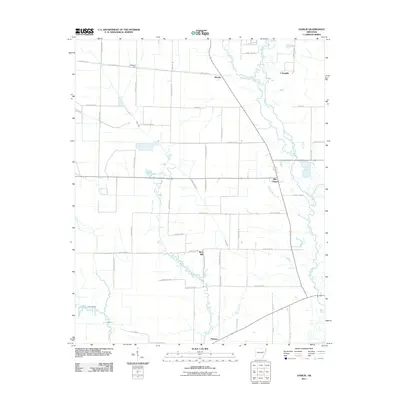
2011 Map of Hamlin
USGS Topo · Published 2011About this map
L'Anguille River meanders through the eastern portion of this St. Francis County landscape, defining the local drainage patterns as it flows south toward Pinetree. This 2011 survey documents a rural Arkansas interior characterized by small agricultural hubs and a dense network of county roads. Settlements like Hamlin and the namesake L'Anguille are linked by thoroughfares such as County Rd 522 and Vines Rd, while the presence of McManus Spur suggests the lingering influence of former rail or industrial access in the north. The area's social and community geography is anchored by landmarks like Ellis Chapel and the small cluster at Wick Mill. Extensive water features, including the braided reaches of the river and seasonal drainage from Malone Branch and First Creek, dictate the layout of the large farm parcels and service roads that dominate the region.
Find a feature on this map
50 named features on this map. Tap any name to fly to it.
Don’t see what you’re looking for? This feature index may not catch every label — zoom into the map to look around manually.
Map Details
Editions of this 2011 Hamlin Map
This is the sole edition of this map. No revisions or reprints were ever made.
Other maps of this area

1939 · Vanndale
USGS Topo · 1:62,500

1939 · Wynne
USGS Topo · 1:62,500

1939 · Hunter
USGS Topo · 1:62,500

1940 · Tilton
USGS Topo · 1:62,500

1953 · Memphis
USGS Topo · 1:250,000

1956 · Memphis
USGS Topo · 1:250,000

1956 · Tilton
USGS Topo · 1:62,500

1956 · Hunter
USGS Topo · 1:62,500

1958 · Hunter
USGS Topo · 1:62,500

1958 · Wynne
USGS Topo · 1:62,500