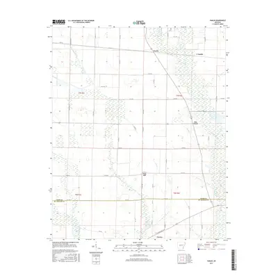
2017 Map of Hamlin
USGS Topo · Published 2017About this map
Pinetree and the southern reaches of the L'Anguille River basin anchor this map of the Arkansas Delta. The landscape is defined by its drainage network, where Malone Br and First Cr weave through a terrain heavily organized by agricultural section lines and rural county roads. Small settlements and points of local interest like Wick Mill and Hamlin serve as landmarks in this agricultural region. The inclusion of Old Military Rd W in the south provides a tangible link to the historic overland transportation routes that once moved people and goods across eastern Arkansas. Further north, Ellis Chapel stands as a focal point for the local community, while the boundary between Cross Co and St. Francis Co cuts horizontally across the map, illustrating the administrative divisions of this low-lying river country.
Find a feature on this map
46 named features on this map. Tap any name to fly to it.
Don’t see what you’re looking for? This feature index may not catch every label — zoom into the map to look around manually.
Map Details
Editions of this 2017 Hamlin Map
This is the sole edition of this map. No revisions or reprints were ever made.
Other maps of this area

1939 · Vanndale
USGS Topo · 1:62,500

1939 · Wynne
USGS Topo · 1:62,500

1939 · Hunter
USGS Topo · 1:62,500

1940 · Tilton
USGS Topo · 1:62,500

1953 · Memphis
USGS Topo · 1:250,000

1956 · Memphis
USGS Topo · 1:250,000

1956 · Tilton
USGS Topo · 1:62,500

1956 · Hunter
USGS Topo · 1:62,500

1958 · Hunter
USGS Topo · 1:62,500

1958 · Wynne
USGS Topo · 1:62,500