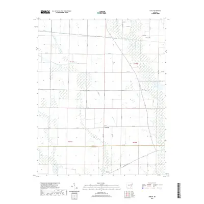
2020 Map of Hamlin
USGS Topo · Published 2020About this map
Pinetree and the southern reaches of Cross and St. Francis Counties anchor this 2020 landscape, where the flatlands of eastern Arkansas are defined by an intricate network of drainage and agricultural transport. The map documents the rural character of the region, featuring small settlements such as Hamlin, Ellis Chapel, and Wick Mill. The L'Anguille River and its tributaries, including Malone Br and First Cr, cut through the terrain, while the historic Old Military Rd W provides a tangible link to the area's development. This survey serves as a modern record of land divisions across Townships t7n r1e and t6n r2e, illustrating the persistent grid of county roads that navigate the bottomlands and wetlands of the St. Francis Basin.
Find a feature on this map
52 named features on this map. Tap any name to fly to it.
Don’t see what you’re looking for? This feature index may not catch every label — zoom into the map to look around manually.
Map Details
Editions of this 2020 Hamlin Map
This is the sole edition of this map. No revisions or reprints were ever made.
Other maps of this area

1939 · Vanndale
USGS Topo · 1:62,500

1939 · Wynne
USGS Topo · 1:62,500

1939 · Hunter
USGS Topo · 1:62,500

1940 · Tilton
USGS Topo · 1:62,500

1953 · Memphis
USGS Topo · 1:250,000

1956 · Memphis
USGS Topo · 1:250,000

1956 · Tilton
USGS Topo · 1:62,500

1956 · Hunter
USGS Topo · 1:62,500

1958 · Hunter
USGS Topo · 1:62,500

1958 · Wynne
USGS Topo · 1:62,500