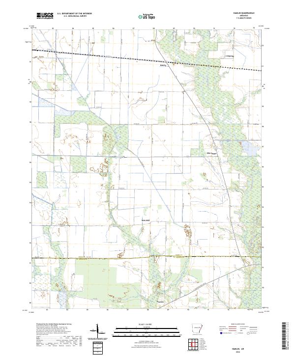
2024 Map of Hamlin
USGS Topo · Published 2024About this map
L'Anguille River and its meandering tributaries define the geography of this Eastern Arkansas landscape, which straddles the boundary between Cross Co and St. Francis Co. The survey documents a network of rural settlements and agricultural crossroads, including the northern hamlet of Hamlin and the southern community of Pinetree. This modern topographic study reveals a highly organized land-use pattern, where section lines are traced by an extensive grid of county roads such as Boeckmann Rd and Taylor Rd. The drainage of the bottomlands is handled by several named waterways, including First Creek and Malone Branch. Key local landmarks that anchor these rural communities are clearly noted, from the industry-linked name of Wick Mill to the congregational center at Ellis Chapel. The map provides a clear picture of the region's contemporary drainage and infrastructure at the time of the 2019 imagery collection.
Find a feature on this map
47 named features on this map. Tap any name to fly to it.
Don’t see what you’re looking for? This feature index may not catch every label — zoom into the map to look around manually.
Map Details
Editions of this 2024 Hamlin Map
This is the sole edition of this map. No revisions or reprints were ever made.
Other maps of this area

1939 · Vanndale
USGS Topo · 1:62,500

1939 · Wynne
USGS Topo · 1:62,500

1939 · Hunter
USGS Topo · 1:62,500

1940 · Tilton
USGS Topo · 1:62,500

1953 · Memphis
USGS Topo · 1:250,000

1956 · Memphis
USGS Topo · 1:250,000

1956 · Tilton
USGS Topo · 1:62,500

1956 · Hunter
USGS Topo · 1:62,500

1958 · Hunter
USGS Topo · 1:62,500

1958 · Wynne
USGS Topo · 1:62,500