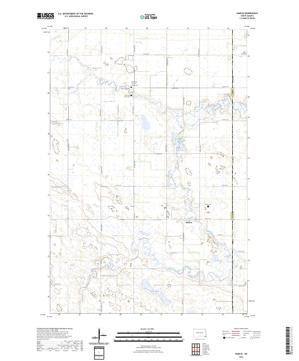
2024 Map of Hamlin
USGS Topo · Published 2024About this map
Wild Rice River winds through this section of the Red River Valley, carving a serpentine path across the prairie landscape near the border of Sargent and Richland counties. The settlement of Hamlin serves as a local focal point, surrounded by a grid of agricultural roads like Co Rd 1 and 150th Ave SE that define the region's rural character. For those tracing family histories, the map identifies several significant landmarks, including the Immanuel Lutheran Church and its associated Immanuel Lutheran Church Cem, along with the Immanuel South Cem further south. To the north of the main settlement, Berre Lake and the nearby Hamlin Cem offer a clear look at the enduring community and geographic features that have anchored this corner of North Dakota for generations.
Find a feature on this map
29 named features on this map. Tap any name to fly to it.
Don’t see what you’re looking for? This feature index may not catch every label — zoom into the map to look around manually.
Map Details
Editions of this 2024 Hamlin Map
This is the sole edition of this map. No revisions or reprints were ever made.
Other maps of this area

1907 · Wyndmere
USGS Topo · 1:125,000

1953 · Fargo
USGS Topo · 1:250,000

1956 · Fargo
USGS Topo · 1:250,000

1958 · Cayuga NW
USGS Topo · 1:24,000

1958 · Hamlin
USGS Topo · 1:24,000

1958 · Geneseo
USGS Topo · 1:24,000
1958 · Cayuga
USGS Topo · 1:24,000

1960 · Wyndmere
USGS Topo · 1:24,000

1960 · De Lamere
USGS Topo · 1:24,000

1960 · Milnor
USGS Topo · 1:24,000