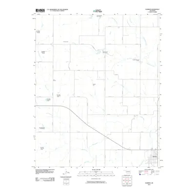
2010 Map of Hammon
USGS Topo · Published 2010About this map
Hammon serves as the primary hub in this western Oklahoma landscape, situated at the junction of the Washita River and White Shield Creek. The area is characterized by a sophisticated network of water management features, including numerous soil conservation structures such as Hughes Dam, the H S Judy Dam, and several numbered sites like Nine Mile Creek Site 11 Dam. These engineering works highlight the 20th-century transition toward intensive watershed management to support the region's agricultural economy.
Find a feature on this map
39 named features on this map. Tap any name to fly to it.
Don’t see what you’re looking for? This feature index may not catch every label — zoom into the map to look around manually.
Map Details
Editions of this 2010 Hammon Map
This is the sole edition of this map. No revisions or reprints were ever made.
Other maps of this area

1955 · Clinton
USGS Topo · 1:250,000

1957 · Clinton
USGS Topo · 1:250,000

1960 · Cheyenne
USGS Topo · 1:62,500

1960 · Hammon
USGS Topo · 1:62,500

1961 · Leedey
USGS Topo · 1:62,500

1966 · Roll SE
USGS Topo · 1:24,000

1984 · Foss Reservoir
USGS Topo · 1:100,000
1987 · Leedey SW
USGS Topo · 1:24,000

1987 · Big Kiowa Creek
USGS Topo · 1:24,000
1987 · Leedey
USGS Topo · 1:24,000