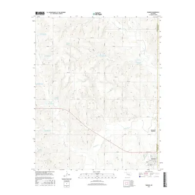
2016 Map of Hammon
USGS Topo · Published 2016About this map
Washita River meanders through the southern portion of this landscape, where the settlement of Hammon serves as a primary hub near the border of Roger Mills and Custer Counties. The town's grid is detailed with streets like Broadway and Clift Ave, while nearby Hammon Junction sits just to the northeast. This era of land management is characterized by an extensive system of water conservation, visible through numerous flood control structures including H S Judy Reservoir, Hughes Reservoir, and a series of numbered catchments along Ninemile Creek.
Find a feature on this map
56 named features on this map. Tap any name to fly to it.
Don’t see what you’re looking for? This feature index may not catch every label — zoom into the map to look around manually.
Map Details
Editions of this 2016 Hammon Map
This is the sole edition of this map. No revisions or reprints were ever made.
Other maps of this area

1955 · Clinton
USGS Topo · 1:250,000

1957 · Clinton
USGS Topo · 1:250,000

1960 · Cheyenne
USGS Topo · 1:62,500

1960 · Hammon
USGS Topo · 1:62,500

1961 · Leedey
USGS Topo · 1:62,500

1966 · Roll SE
USGS Topo · 1:24,000

1984 · Foss Reservoir
USGS Topo · 1:100,000
1987 · Leedey SW
USGS Topo · 1:24,000

1987 · Big Kiowa Creek
USGS Topo · 1:24,000
1987 · Leedey
USGS Topo · 1:24,000