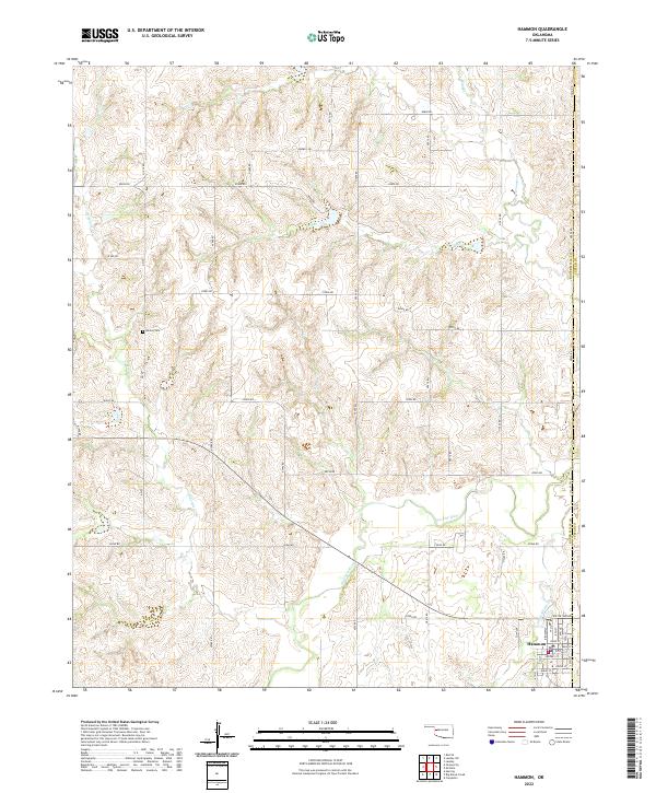
2022 Map of Hammon
USGS Topo · Published 2022About this map
The Washita River carves a winding path through this western Oklahoma landscape, defining the topography south of the Roger Mills Co Custer Co border. The town of Hammon sits at the convergence of several local waterways, including White Shield Cr, which joins the river just east of the primary settlement. The town's grid is clearly defined by historical thoroughfares such as Main St, Foster St, and Sisson St, providing a detailed look at the local layout in the early twenty-first century. Away from the town center, the terrain is marked by a network of rural section-line roads and several small tributaries like Dry Br and Quartermaster Cr. For genealogists and local historians, the Barker Cem remains a significant landmark situated on the upland breaks north of Ninemile Cr.
Find a feature on this map
35 named features on this map. Tap any name to fly to it.
Don’t see what you’re looking for? This feature index may not catch every label — zoom into the map to look around manually.
Map Details
Editions of this 2022 Hammon Map
This is the sole edition of this map. No revisions or reprints were ever made.
Other maps of this area

1955 · Clinton
USGS Topo · 1:250,000

1957 · Clinton
USGS Topo · 1:250,000

1960 · Cheyenne
USGS Topo · 1:62,500

1960 · Hammon
USGS Topo · 1:62,500

1961 · Leedey
USGS Topo · 1:62,500

1966 · Roll SE
USGS Topo · 1:24,000

1984 · Foss Reservoir
USGS Topo · 1:100,000
1987 · Leedey SW
USGS Topo · 1:24,000

1987 · Big Kiowa Creek
USGS Topo · 1:24,000
1987 · Leedey
USGS Topo · 1:24,000