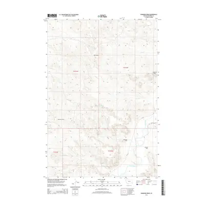
2014 Map of Hammond Draw
USGS Topo · Published 2014About this map
The Tongue River meanders through this portion of Rosebud County, serving as the primary drainage for a landscape defined by deep draws and isolated high points. Significant landforms like Trembling Butte rise above the surrounding terrain, while seasonal watercourses such as Sand Coulee, Alfalfa Cr, and Joe Leg Cr cut through the dry hills. The map highlights the intersection of modern transit and traditional land divisions, showing MT-332 and Brandenberg Rd as they navigate the contours of the Hammond Draw and Houston Draw. This 2014 survey documents the hydrographic patterns of the region, including the Roe and Cooper Cr and the unique 01N44E30BDCA01 Spring, providing a clear view of the ranching country and the intricate drainage network that feeds the larger river system in eastern Montana.
Find a feature on this map
17 named features on this map. Tap any name to fly to it.
Don’t see what you’re looking for? This feature index may not catch every label — zoom into the map to look around manually.
Map Details
Editions of this 2014 Hammond Draw Map
This is the sole edition of this map. No revisions or reprints were ever made.
Other maps of this area

1954 · Hardin
USGS Topo · 1:250,000

1957 · Hardin
USGS Topo · 1:250,000

1958 · Hardin
USGS Topo · 1:250,000

1958 · Garfield Peak
USGS Topo · 1:24,000

1966 · Cook Creek Reservoir
USGS Topo · 1:24,000

1966 · Ashland NE
USGS Topo · 1:24,000
1971 · Brandenberg NW
USGS Topo · 1:24,000

1971 · Hammond Draw NW
USGS Topo · 1:24,000

1971 · Hammond Draw
USGS Topo · 1:24,000
1971 · Hammond Draw SW
USGS Topo · 1:24,000