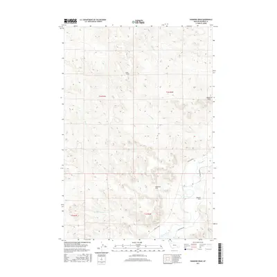
2017 Map of Hammond Draw
USGS Topo · Published 2017About this map
The Tongue River winds through the southeastern corner of this Rosebud County landscape, a vital water source that has long dictated movement and settlement in this part of Montana. The terrain is defined by complex drainage systems and significant landforms like Trembling Butte and the wide depression of Sand Coulee. The map shows a region shaped by its namesake, Hammond Draw, and the neighboring Houston Draw, where the relief drops toward the river valley. Transportation follows these natural contours, with Tongue River Rd and Brandenberg Rd serving as the primary connectors between the creek-fed drainages of Alfalfa Cr and Joe Leg Cr. This 2017 survey provides a clear look at the contemporary land divisions and the intricate network of seasonal waterways like Roe and Cooper Cr that drain the high ground.
Find a feature on this map
16 named features on this map. Tap any name to fly to it.
Don’t see what you’re looking for? This feature index may not catch every label — zoom into the map to look around manually.
Map Details
Editions of this 2017 Hammond Draw Map
This is the sole edition of this map. No revisions or reprints were ever made.
Other maps of this area

1954 · Hardin
USGS Topo · 1:250,000

1957 · Hardin
USGS Topo · 1:250,000

1958 · Hardin
USGS Topo · 1:250,000

1958 · Garfield Peak
USGS Topo · 1:24,000

1966 · Cook Creek Reservoir
USGS Topo · 1:24,000

1966 · Ashland NE
USGS Topo · 1:24,000
1971 · Brandenberg NW
USGS Topo · 1:24,000

1971 · Hammond Draw NW
USGS Topo · 1:24,000

1971 · Hammond Draw
USGS Topo · 1:24,000
1971 · Hammond Draw SW
USGS Topo · 1:24,000