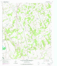
1962 Map of Hammond
USGS Topo · Published 1978About this map
The Southern Pacific rail line bisects the landscape of Robertson County, following a straight north-south corridor that anchors the settlement of Hammond. This rural region is defined by its network of community institutions, including Bethlehem Ch, Shiloh Ch, and Mt Moriah Ch, which stand as key landmarks for local family historians and genealogists. Educational sites like the Hammond High Sch and Anderson Sch further illustrate the early 1960s social geography of this Central Texas area.
Find a feature on this map
31 named features on this map. Tap any name to fly to it.
Don’t see what you’re looking for? This feature index may not catch every label — zoom into the map to look around manually.
Map Details
Editions of this 1962 Hammond Map
3 editions found
Other maps of this area

1954 · Waco
USGS Topo · 1:250,000

1954 · Austin
USGS Topo · 1:250,000

1955 · Waco
USGS Topo · 1:250,000

1961 · Hearne North
USGS Topo · 1:24,000

1961 · Baileyville
USGS Topo · 1:24,000

1962 · Calvert
USGS Topo · 1:24,000

1962 · Maysfield
USGS Topo · 1:24,000

1962 · Hammond
USGS Topo · 1:24,000

1962 · Reagan
USGS Topo · 1:24,000

1962 · Bremond
USGS Topo · 1:24,000