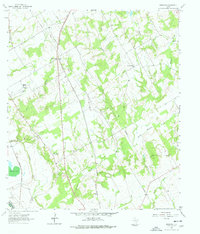
1962 Map of Hammond
USGS Topo · Published 1978About this map
The Southern Pacific railroad cuts a straight north-south line through the heart of Robertson County, anchoring the settlement of Hammond and its surrounding agricultural landscape. This 1962 field-checked environment reveals a high density of rural social infrastructure, with numerous country churches such as Bethlehem Ch, Shiloh Ch, and St Paul Ch serving the scattered homesteads of Tidwell Prairie. The landscape is defined by the complex drainage systems of Walnut Creek and Bee Branch, which flow toward the western boundary marked by the Brazos River.
Find a feature on this map
30 named features on this map. Tap any name to fly to it.
Don’t see what you’re looking for? This feature index may not catch every label — zoom into the map to look around manually.
Map Details
Editions of this 1962 Hammond Map
3 editions found
Other maps of this area

1954 · Waco
USGS Topo · 1:250,000

1954 · Austin
USGS Topo · 1:250,000

1955 · Waco
USGS Topo · 1:250,000

1961 · Hearne North
USGS Topo · 1:24,000

1961 · Baileyville
USGS Topo · 1:24,000

1962 · Calvert
USGS Topo · 1:24,000

1962 · Maysfield
USGS Topo · 1:24,000

1962 · Hammond
USGS Topo · 1:24,000

1962 · Reagan
USGS Topo · 1:24,000

1962 · Bremond
USGS Topo · 1:24,000