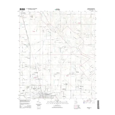
2015 Map of Hammond
USGS Topo · Published 2015About this map
Hammond and its surrounding Tangipahoa Parish communities appear in high detail during this mid-2010s survey, illustrating the dense suburban and institutional growth concentrated around the Southeastern Louisiana University campus. The Illinois Central RR remains a defining corridor through the heart of the parish, linking Independence, Tickfaw, and Natalbany as it parallels the main north-south highway. This industrial and transit backbone is countered by the winding path of the Tangipahoa River and its numerous tributaries like Selsers Creek and Ponchatoula Creek. Genealogists will find a significant number of family-named burial grounds, including Mount Stevens Cemetery, Tycer Cemetery, and Narretto Cemetery. The map also captures the expansion of neighborhood clusters such as Whitmar Acres, Woodland Park, and University Place, showing the evolution of the landscape from timber and rail roots to a modern university and regional hub.
Find a feature on this map
120 named features on this map. Tap any name to fly to it.
Don’t see what you’re looking for? This feature index may not catch every label — zoom into the map to look around manually.
Map Details
Editions of this 2015 Hammond Map
This is the sole edition of this map. No revisions or reprints were ever made.
Other maps of this area

1934 · Springfield
USGS Topo · 1:62,500

1935 · Ponchatoula
USGS Topo · 1:62,500

1939 · Ponchatoula
USGS Topo · 1:62,500

1939 · Springfield
USGS Topo · 1:62,500

1940 · Tickfaw
USGS Topo · 1:31,680

1942 · Husser
USGS Topo · 1:31,680

1942 · Robert
USGS Topo · 1:31,680

1942 · Loranger
USGS Topo · 1:31,680

1949 · Amite
USGS Topo · 1:31,680

1949 · Albany
USGS Topo · 1:31,680