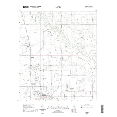
2020 Map of Hammond
USGS Topo · Published 2020About this map
The Tangipahoa River defines the eastern wetlands of this 2020 landscape, while the city of Hammond serves as the primary hub of development in Tangipahoa Parish. The presence of Southeastern Louisiana University and its North Campus creates a significant institutional footprint in the southwest, while the Hammond Northshore Regional Airport occupies a large tract to the east.
Find a feature on this map
93 named features on this map. Tap any name to fly to it.
Don’t see what you’re looking for? This feature index may not catch every label — zoom into the map to look around manually.
Map Details
Editions of this 2020 Hammond Map
This is the sole edition of this map. No revisions or reprints were ever made.
Other maps of this area

1934 · Springfield
USGS Topo · 1:62,500

1935 · Ponchatoula
USGS Topo · 1:62,500

1939 · Ponchatoula
USGS Topo · 1:62,500

1939 · Springfield
USGS Topo · 1:62,500

1940 · Tickfaw
USGS Topo · 1:31,680

1942 · Husser
USGS Topo · 1:31,680

1942 · Robert
USGS Topo · 1:31,680

1942 · Loranger
USGS Topo · 1:31,680

1949 · Amite
USGS Topo · 1:31,680

1949 · Albany
USGS Topo · 1:31,680