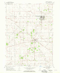
1968 Map of Hampshire
USGS Topo · Published 1970About this map
The agrarian landscape of the De Kalb Co Kane Co border is defined by a rigid grid of country roads and the critical paths of mid-century rail transport. In the late 1960s, the village of Hampshire served as a concentrated hub along the Chicago Milwaukee St Paul and Pacific line, while further south, the Illinois Central corridor passes through Burlington. The map reveals a highly structured rural economy, where family-named routes like Lenschow Road, Ellithorpe Road, and Rohrsen Rd connect dispersed farmsteads to these small rail centers. Local history and genealogy are anchored by landmarks such as the Hampshire Center Cem and Burlington Union Cem, while industrial activity is noted at the Gravel Pits and the small settlement of New Lebanon along Coon Creek.
Find a feature on this map
32 named features on this map. Tap any name to fly to it.
Don’t see what you’re looking for? This feature index may not catch every label — zoom into the map to look around manually.
Map Details
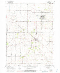
Editions of this 1968 Hampshire Map
2 editions found
Other maps of this area

1925 · Elgin
USGS Topo · 1:62,500

1932 · Geneva
USGS Topo · 1:62,500

1937 · Sycamore
USGS Topo · 1:62,500

1938 · Genoa
USGS Topo · 1:62,500

1940 · Elgin
USGS Topo · 1:62,500

1948 · Geneva
USGS Topo · 1:62,500

1954 · Rockford
USGS Topo · 1:250,000

1955 · Rockford
USGS Topo · 1:250,000

1958 · Aurora
USGS Topo · 1:250,000

1958 · Rockford
USGS Topo · 1:250,000