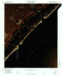
1980 Map of Hampstead
USGS Topo · Published 1986About this map
The coastal community of Hampstead and its intricate waterway network are captured here through infrared aerial imagery, revealing the complex interface of mainland Pender County and the Atlantic Ocean. The settlement of Browntown sits inland from the marshes, while the barrier island features the town of Topsail Beach. The landscape is defined by the Banks and a series of navigable passages, including Long Point Channel and Topsail Channel, which connect the interior creeks to the open sea. Numerous small water bodies like Old Topsail Creek, Mill Creek, and Futch Creek drain the coastal plain. Near the northern edge, Kings Landing serves as a notable landmark along the marshy shore. This orthophotomap provides a distinct perspective on the 1980 shoreline and the distribution of residential development before the rapid expansion of later decades.
Find a feature on this map
14 named features on this map. Tap any name to fly to it.
Don’t see what you’re looking for? This feature index may not catch every label — zoom into the map to look around manually.
Map Details
Editions of this 1980 Hampstead Map
This is the sole edition of this map. No revisions or reprints were ever made.
Other maps of this area

1942 · Topsail
USGS Topo · 1:62,500

1942 · Wilmington
USGS Topo · 1:62,500

1947 · Rocky Point
USGS Topo · 1:62,500

1948 · Topsail
USGS Topo · 1:62,500

1948 · Wilmington
USGS Topo · 1:62,500

1953 · Beaufort
USGS Topo · 1:250,000

1954 · Beaufort
USGS Topo · 1:250,000

1970 · Hampstead
USGS Topo · 1:24,000
1970 · Wrightsville Beach
USGS Topo · 1:24,000

1970 · Topsail
USGS Topo · 1:24,000