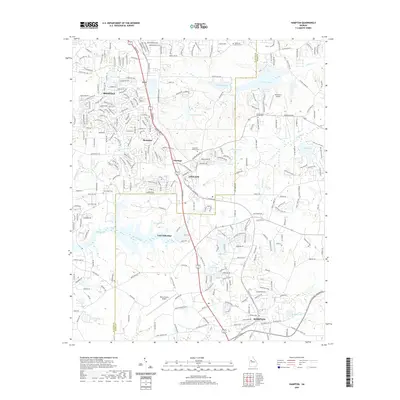
2020 Map of Hampton
USGS Topo · Published 2020About this map
The growing town of Hampton and the community of Lovejoy anchor this 2020 landscape along the border of Clayton and Henry Counties. The corridor follows Tara Blvd, which links several established residential clusters including Irondale, Orrs, and Hastings. This modern survey reveals a landscape heavily shaped by local aviation and private water management, with Henry County Airport and Diamond S Airport serving the region. Numerous named impoundments such as Lake Talmadge, Hermans Lake, and Shamrock Lake define the suburban hydrology between the drainages of Pates Creek and Walnut Creek. Genealogists will find significant value in the documentation of local burial grounds, including the Noahs Ark Church Cem, the County Line Church Cem, and the Crawford - Dorsey Cem, which persist even as residential development expands into the surrounding countryside.
Find a feature on this map
287 named features on this map. Tap any name to fly to it.
Don’t see what you’re looking for? This feature index may not catch every label — zoom into the map to look around manually.
Map Details
Editions of this 2020 Hampton Map
This is the sole edition of this map. No revisions or reprints were ever made.
Other maps of this area

1888 · Atlanta
USGS Topo · 1:125,000

1890 · Atlanta
USGS Topo · 1:125,000

1892 · Atlanta
USGS Topo · 1:125,000

1895 · Atlanta
USGS Topo · 1:125,000

1953 · Atlanta
USGS Topo · 1:250,000

1954 · Jonesboro
USGS Topo · 1:24,000

1954 · Riverdale
USGS Topo · 1:24,000

1957 · Atlanta
USGS Topo · 1:250,000

1958 · Atlanta
USGS Topo · 1:250,000

1964 · Luella
USGS Topo · 1:24,000