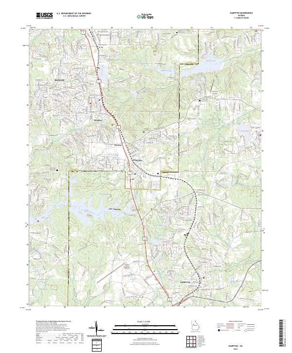
2024 Map of Hampton
USGS Topo · Published 2024About this map
Lovejoy and Hampton anchor this detailed study of the south Atlanta suburbs, where the border between Clayton and Henry counties is defined by a dense network of water bodies and transportation hubs. Modern infrastructure, including the Atlanta Speedway Airport and the Diamond S Airport, neighbors established rural foundations like the County Line Church Cem and Dorsey Cem. The landscape is notably defined by its reservoirs and creeks, from the large expanse of Lake Talmadge and Sinback Lake to the headwaters of the Towaliga River. Small settlements such as Bonanza, Hastings, and Irondale are scattered along the major road corridors, while numerous smaller lakes like Shamrock Lake, Harbins Lake, and Lake Cindy fragment the terrain. This map documents a transition from historic community centers such as Noah's Ark Church toward the modern residential and commercial developments that characterize the contemporary Georgia Piedmont.
Find a feature on this map
287 named features on this map. Tap any name to fly to it.
Don’t see what you’re looking for? This feature index may not catch every label — zoom into the map to look around manually.
Map Details
Editions of this 2024 Hampton Map
This is the sole edition of this map. No revisions or reprints were ever made.
Other maps of this area

1888 · Atlanta
USGS Topo · 1:125,000

1890 · Atlanta
USGS Topo · 1:125,000

1892 · Atlanta
USGS Topo · 1:125,000

1895 · Atlanta
USGS Topo · 1:125,000

1953 · Atlanta
USGS Topo · 1:250,000

1954 · Jonesboro
USGS Topo · 1:24,000

1954 · Riverdale
USGS Topo · 1:24,000

1957 · Atlanta
USGS Topo · 1:250,000

1958 · Atlanta
USGS Topo · 1:250,000

1964 · Luella
USGS Topo · 1:24,000