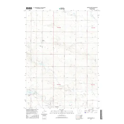
2015 Map of Hampton North
USGS Topo · Published 2015About this map
Beeds Lake serves as a focal point for this northern Iowa landscape, where agricultural section lines intersect with the winding paths of Buffalo Cr and Otter Creek. The northern edge of Hampton anchors the map's southern border, while the small settlement of Chapin sits central to the township grid. This 2015 survey reflects a deeply ingrained rural structure, where family farms and local history are marked by sites like the Way Side Cem and the Beeds Lake Airport. The terrain is defined by the headwaters of several drainages, including Bailey Creek and the West Fork Cedar River, illustrating the watershed patterns that shaped the development of Franklin County. Transportation is defined by a strictly surveyed network of local roads such as Beeds Lake Rd and Co Hwy S43, which connect the scattered homesteads to the region's commerce centers.
Find a feature on this map
38 named features on this map. Tap any name to fly to it.
Don’t see what you’re looking for? This feature index may not catch every label — zoom into the map to look around manually.
Map Details
Editions of this 2015 Hampton North Map
This is the sole edition of this map. No revisions or reprints were ever made.
Other maps of this area

1954 · Waterloo
USGS Topo · 1:250,000

1955 · Waterloo
USGS Topo · 1:250,000

1972 · Hansell
USGS Topo · 1:24,000
1972 · Dougherty
USGS Topo · 1:24,000

1972 · Swaledale
USGS Topo · 1:24,000
1972 · Sheffield
USGS Topo · 1:24,000

1972 · Latimer
USGS Topo · 1:24,000

1972 · Hampton North
USGS Topo · 1:24,000

1979 · Ackley NE
USGS Topo · 1:24,000

1979 · Coulter
USGS Topo · 1:24,000