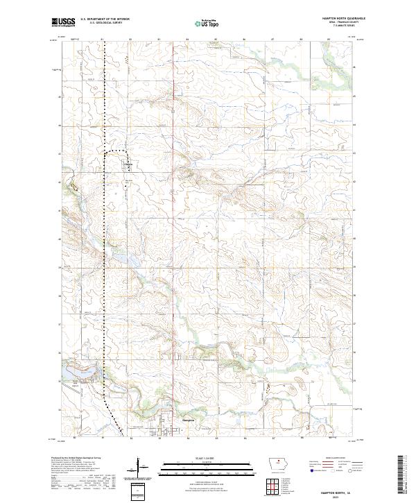
2023 Map of Hampton North
USGS Topo · Published 2023About this map
Chapin and the northern reaches of Hampton anchor this survey of the Franklin County countryside. The landscape is defined by the headwaters and tributaries of the West Fork Cedar River, including the winding paths of Otter Creek, Buffalo Creek, and Bailey Creek. A significant recreational and topographical focal point is Beeds Lake, formed by the impoundment of Beeds Creek, which sits adjacent to Lake Airport. The map documents a highly structured agricultural grid, where namesake roads like Nettle Ave and Raven Ave intersect with numbered routes. For local historians, the placement of the Way Side Cem north of Hampton offers a specific point of genealogical interest within the township divisions of t93n r20w and t92n r20w.
Find a feature on this map
43 named features on this map. Tap any name to fly to it.
Don’t see what you’re looking for? This feature index may not catch every label — zoom into the map to look around manually.
Map Details
Editions of this 2023 Hampton North Map
This is the sole edition of this map. No revisions or reprints were ever made.
Other maps of this area

1954 · Waterloo
USGS Topo · 1:250,000

1955 · Waterloo
USGS Topo · 1:250,000

1972 · Hansell
USGS Topo · 1:24,000
1972 · Dougherty
USGS Topo · 1:24,000

1972 · Swaledale
USGS Topo · 1:24,000
1972 · Sheffield
USGS Topo · 1:24,000

1972 · Latimer
USGS Topo · 1:24,000

1972 · Hampton North
USGS Topo · 1:24,000

1979 · Ackley NE
USGS Topo · 1:24,000

1979 · Coulter
USGS Topo · 1:24,000