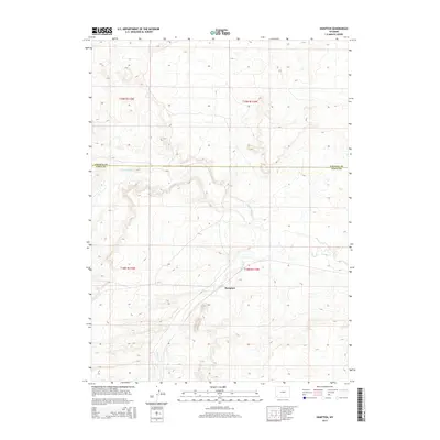
2015 Map of Hampton
USGS Topo · Published 2015About this map
Hampton serves as a central point of reference in this landscape at the border of Lincoln Co and Uinta Co in southwestern Wyoming. The area is defined by a seasonal hydrology, where the winding courses of Muddy Cr and Little Muddy Cr navigate the high desert terrain. The drainage patterns of these creeks suggest a landscape shaped by intermittent water flow, typical of the region's ranching or energy-producing history. Surveyed under the Public Land Survey System, the map detail reflects the township and range divisions of t18n r114w and surrounding sections, illustrating how geographic boundaries were imposed upon this western terrain. The sparse settlement pattern highlights the significance of small named locales like Hampton for local history and genealogical research in this part of the state.
Find a feature on this map
8 named features on this map. Tap any name to fly to it.
Don’t see what you’re looking for? This feature index may not catch every label — zoom into the map to look around manually.
Map Details
Editions of this 2015 Hampton Map
This is the sole edition of this map. No revisions or reprints were ever made.
Other maps of this area

1954 · Ogden
USGS Topo · 1:250,000

1958 · Ogden
USGS Topo · 1:250,000

1960 · Ogden
USGS Topo · 1:250,000

1964 · Carter
USGS Topo · 1:24,000

1964 · Austin Reservoir
USGS Topo · 1:24,000
1965 · Millersville
USGS Topo · 1:24,000

1969 · Church Butte NW
USGS Topo · 1:24,000

1969 · Roberson Creek
USGS Topo · 1:24,000

1969 · Hampton
USGS Topo · 1:24,000
1969 · Church Butte
USGS Topo · 1:24,000