
1968 Map of Hancock
USGS Topo · Published 1971About this map
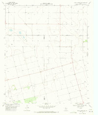
Hancock sits at the junction of State Route 178 and local roads, serving as the primary human settlement in this section of Dawson County during the late 1960s. The landscape is defined by the stark transition from agricultural fields in the west to the deeply incised drainage of Tobacco Creek and Rock Canyon in the east. These geological features reveal a complex network of branching tributaries, including T J F Draw, that carve through the High Plains terrain. Evidence of the region's energy and infrastructure needs is visible through the presence of scattered Oil Wells, a significant Pipeline, and a Water Tank, reflecting the logistical realities of West Texas ranching and industrial activity. A small Cem near the settlement provides a grounded point of interest for genealogists tracing family roots in this rural community.
Find a feature on this map
10 named features on this map. Tap any name to fly to it.
Don’t see what you’re looking for? This feature index may not catch every label — zoom into the map to look around manually.
Map Details
Editions of this 1968 Hancock Map
This is the sole edition of this map. No revisions or reprints were ever made.
Other maps of this area

1954 · Big Spring
USGS Topo · 1:250,000

1958 · Big Spring
USGS Topo · 1:250,000

1968 · Lamesa North
USGS Topo · 1:24,000

1969 · Gooch Lake
USGS Topo · 1:24,000

1969 · O'Donnell
USGS Topo · 1:24,000

1969 · Indian Canyon
USGS Topo · 1:24,000
1970 · Indian Canyon NW
USGS Topo · 1:24,000

1970 · Lamesa South
USGS Topo · 1:24,000

1970 · Key
USGS Topo · 1:24,000

1970 · Sand Creek
USGS Topo · 1:24,000