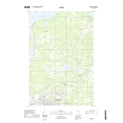
2019 Map of Hancock
USGS Topo · Published 2019About this map
The industrial legacy of the Copper Country is preserved across Keweenaw National Historical Park, where the urban landscape of Hancock meets the remnants of 19th-century mining. The map documents the tight concentration of company settlements and shafts, including Franklin Mine, Pewabic, and Lower Pewabic, situated along the slopes of Arcadian Hill. These sites, linked by the Hancock to Calumet Route, reflect an era when mineral extraction defined the regional economy and town planning. Along the Keweenaw Waterway, the community of Ripley and the outskirts of Houghton border the canal, while the Keweenaw State Trail follows the former rail corridors that once hauled ore to the stamps. Higher on the peninsula, the landscape transitions to rural homesteads and woodlands, marked by family-named cemeteries like Waasa Cem and the quiet waters of Bear Lake.
Find a feature on this map
90 named features on this map. Tap any name to fly to it.
Don’t see what you’re looking for? This feature index may not catch every label — zoom into the map to look around manually.
Map Details
Editions of this 2019 Hancock Map
This is the sole edition of this map. No revisions or reprints were ever made.
Other maps of this area

1915 · Houghton
USGS Topo · 1:62,500

1941 · Ahmeek
USGS Topo · 1:31,680

1946 · Hancock
USGS Topo · 1:24,000

1946 · Chassell
USGS Topo · 1:24,000

1946 · South Range
USGS Topo · 1:24,000

1946 · Muggun Creek
USGS Topo · 1:24,000

1946 · Ahmeek
USGS Topo · 1:24,000

1946 · Laurium
USGS Topo · 1:24,000

1947 · Ahmeek
USGS Topo · 1:24,000

1948 · South Range
USGS Topo · 1:24,000