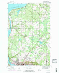
2023 Map of Hancock
USGS Topo · Published 2023About this map
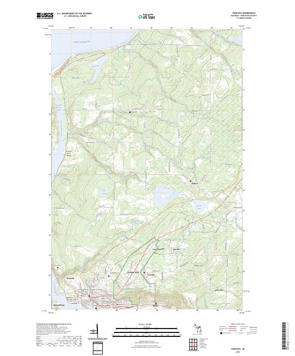
The Keweenaw National Historical Park anchors this study of Michigan's Copper Country, documenting the enduring footprint of the mining industry in the Keweenaw Peninsula. Centered on the city of Hancock and the northern edge of Houghton, the landscape is defined by its industrial heritage, featuring historic company settlements like Franklin Mine, Pewabic, and Lewer Pewabic. These clusters, along with the neighborhood of Ripley and the community of Dollar Bay, follow the shores of the Keweenaw Waterway, a vital maritime link connecting to Lake Superior.
Find a feature on this map
91 named features on this map. Tap any name to fly to it.
Don’t see what you’re looking for? This feature index may not catch every label — zoom into the map to look around manually.
Map Details
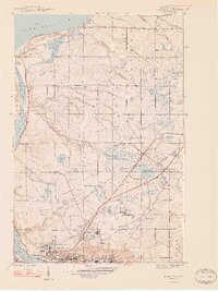
Editions of this 2023 Hancock Map
This is the sole edition of this map. No revisions or reprints were ever made.
Historical Maps of Frenchtown Through Time
9 maps found